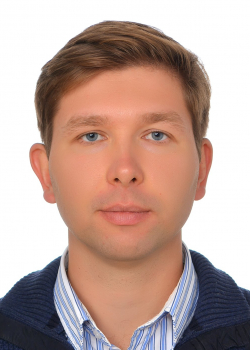
Івано-Франківський національний технічний університету нафти і газу (2009):
- cпеціальність: «Геодезія»;
- кваліфікація: інженер-геодезист.
кандидат технічних наук, 2016 р.
доцент кафедри геодезії та землеустрою, 2021 р.
Івано-Франківський національний технічний університету нафти і газу, доцент кафедри геодезії та землеустрою
• супутникова радіолокаційна інтерферометрія;
• гляціологічні дослідження;
• геодинаміка;
• дистанційне зондування Землі;
• геодезичний моніторинг інженерних об’єктів;
Доцент кафедри геодезії та землеустрою, доцент, кандидат технічних наук
Викладає дисципліни:
- Геодезія
- Фізична геодезія
- Референцні системи координат у землеустрої
- Geodesy
- Кандидатська дисертація на тему: «Геодезичний контроль надземних переходів магістральних газопроводів із застосуванням електронних тахеометрів у безрефлекторному режимі вимірювань» (спеціальність 05.24.01 – геодезія, фотограмметрія та картографія).
- Є автором понад 50-ти наукових публікацій, в тому числі двох монографій.
Scopus (Author ID): 57203755866
ORCID: https://orcid.org/0000-0002-2839-4318
Учать у міжнародних проєктах
- Участь у проекті «UNIVERSEH Extended for Ukraine» Space Technology Centre AGH UST, Krakow, Poland, 15-19 May 2023.
- Виконавець проекту «Development of cross-border cooperation in promoting objects of historical and cultural heritage in the cross-border territory of Romania and Ukraine» (2020-2023 рр.).
Монографії:
• Тревого І. С., Ільків Є. Ю., Кухтар Д. В., Нікітенко К. О. Геодезичний контроль деформацій споруд магістральних газопроводів: Монографія. 2-ге вид., допов. та випр. Івано-Франківськ: ІФНТУНГ, 2022. 338 с. ISBN 978-966-694-404-0
Публікації, які індексуються в наукометричних базах Scopus та WoS:
• Tretyak, K., & Kukhtar, D. (2023). Application of Sntinel-1 radar interferometric images for the monitoring of vertical displacements of the earth’s surface affected by non-tidal atmospheric loading. Geofizicheskiy Zhurnal, 45(1). https://doi.org/10.24028/gj.v45i1.275180
• Kukhtar, D. Ice glacier velocity determination using Sentinel-1 data: a case study on Wiggins glacier, West Antarctica, 2015-2017 / K. Tretyak, D. Kukhtar // International Conference of Young Professionals «GeoTerrace-2022», 3-5 October 2022, Lviv, Ukraine, 2022. DOI: 10.3997/2214-4609.2022590004
• Kukhtar, D. Research and Improvement of Bimetal Benchmark Construction / I. Trevoho, E. Ilkiv, M. Halyarnyk, D. Kukhtar, O. Hrushko // International Conference of Young Professionals «GeoTerrace-2022», 3-5 October 2022, Lviv, Ukraine, 2022. DOI: 10.3997/2214-4609.2022590041
• Kukhtar, D. Opportunities and Limitations for Ground Motion Mapping Using InSAR Technique / K. Tretyak, D. Kukhtar, M. Prykhodko, V. Romaniuk, I. Bodnaruk, O. Vyrstyuk // Geoinformatics 2021, May 2021, Kiev, Ukraine, 2021.
• Kukhtar, D. Algorithm of creating a cartographic basis for newly-formed territorial communities / V. Romaniuk, D. Kukhtar, M. Prykhodko, I. Bodnaruk, I. Dovhan // Geoinformatics 2021, May 2021, Kiev, Ukraine, 2021.
• Kukhtar, D. Application of geoinformation technologies for implementation of the concept of ecosystem services in Ukraine /M. Prykhodko, V. Romaniuk, D. Kukhtar, I. Bodnaruk, S. Vyrsta // Geoinformatics 2021, May 2021, Kiev, Ukraine, 2021.
• Kukhtar, D. Geophysical monitoring of geospatial data infrastructure as a component of the state environmental monitoring system / I. Trevoho, E. Ilkiv, M. Halyarnyk, D. Kukhtar // GeoTerrace-2020, 07-09 December 2020, Lviv, Ukraine, 2020.
• Kukhtar, D. Geodetic monitoring of the hotel complex in the mountain region / Romaniuk, V.V., Kukhtar, D.V., Mykhailyshyn V. P., Hrynishak M. Y. // GeoTerrace-2020, 07-09 December 2020, Lviv, Ukraine, 2020.
• Kukhtar, D. Use of geoinformation technology to study the structure and morphometric parameters of river basins / Prykhodko, M.M., Romaniuk, V.V., Kukhtar, D.V., Bodnaruk, I.L., Adamovych, M.V. // Geoinformatics 2020, May 2020, Kiev, Ukraine, 2020.
• Kukhtar, D. Forecasting temperature behavior of soil in gas field exploitation areas / Prykhodko, M.M., Poberezhny, L.Y., Romaniuk, V.V., Kukhtar, D.V., Bodnaruk, I.L., Muliar, A.V. // Geoinformatics 2020, May 2020, Kiev, Ukraine, 2020.
• Kukhtar, D. Detection of Deforestation Areas Using Satellite Images / Ripetskyi, Ye.Yo., Romaniuk, V.V., Kukhtar, D.V., Dorosh, L. I., Serediuk, S.R. // Monitoring of Geological Processesand Ecological Condition of the Environment 2019, Nov 2019, Kiev, Ukraine, 2019.
• Kukhtar, D. Application of the geographic information system technologies in the geosystem planning process / Prykhodko, M.M., Romaniuk, V.V., Kukhtar, D.V., Bodnaruk, I.L., Khmil, N.L. // Geoinformatics 2019, May 2019, Kiev, Ukraine, 2019.
• Kukhtar D. Modelling the accuracy equation of Sokkia 530rk reflectorless total station due to incident angle on the above-ground pipeline’s surface / D. Kukhtar, V. Romaniuk, I. Savchyn// Geodetski List 72(3), 2018, p. 197-216.
• Kukhtar, D. A modern approach to monitoring the territories of solid waste landfills / Prykhodko M.M., Romaniuk V.V., Kukhtar D.V., Rodzinska O.V. // Geoinformatics 2018, 14-17 May 2018, Kiev, Ukraine, 2018., DOI: 10.3997/2214-4609.201801829
Публікації у фахових та закордонних виданнях:
• Кухтар Д. Аналіз забезпечення територій пунктами Державної геодезичної мережі / Тревого І. С., Кухтар Д. В., Ільків Є. Ю., Галярник М. В. // Сучасні досягнення геодезичної науки та виробництва. Львів, 2021. №2 (42). С. 35-43. DOI: www.doi.org/10.33841/1819-1339-2-42-35-43
• Kachala Т. & Kukhtar D. (2021). ASSESSMENT OF THE LEVEL OF GREENING OF THE URBAN ECOSYSTEM OF THE CITY AND DEVELOPMENT OF MEASURES FOR ITS OPTIMIZATION ON THE EXAMPLE OF M. IVANO-FRANKIVSKA. Ecological Safety and Balanced Use of Resources, (1(23), 33–45. https://doi.org/10.31471/2415-3184-2021-1(23)-33-45
denys.kukhtar@nung.edu.ua
